(Cross posted at
Big Monkey, Helpy Chalk, where I've been posting general travelogue stuff, rather than philosophical reflections.)
Like the St. Lawrence, the Yangtze is not really a river, but a "seaway," with all aspects of the river ecosystem pushed out by the needs of shipping. You don't see many people fishing on the river. This visit I only saw one fishing boat, although last time, when I spend more time and covered a longer stretch of the river I saw more. Mostly what you see is this:
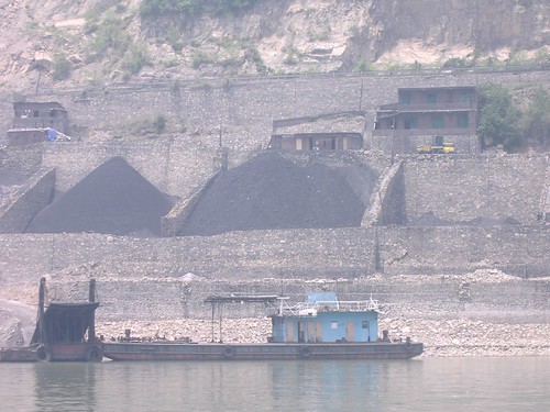
Coal, the blood of the current Chinese economy. Small hoppers of coal line the banks of the Yangtze. Dump trucks bring the coal, typically from small, independently run mines with poor safety standards. The kind of mining disaster that makes national news for weeks if it happens in West Virginia happens every day in China.
Concrete reinforced banks add a lot to the sense that the Yangtze is a highway.
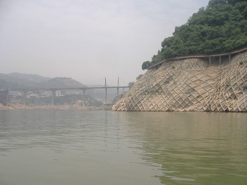
To deal with erosion after the flooding caused by the new dam, the government put nets over the steeper banks of the river and coated them with concrete. Most of this will be under water when the dam is fully operational. In case you forget how high the water will be by then, there are constant reminders
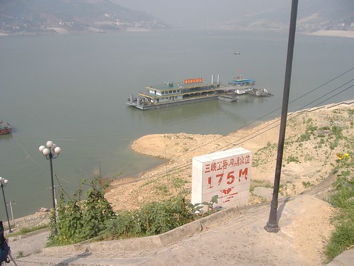
Officially, the flooding has forced the resettlement of 1.1 million people, including 13 major cities and about 25 thousand hectares of farmland. (This according to the handy yellow technical guide given to tourists by the government.) Most of these people are moved to brand new relocation cities built a little farther up the river bank. About 10% are moved to entirely new provinces. The consensus seems to be that those 10% are totally fucked.
The relocation cities are quite a sight. They all have built docks at 175 m. above sea level, but since the river isn't there yet, you see huge foundations of the docks.
This is the dock for Fengjie. For some reason water was gushing down the side.
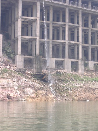
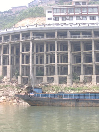
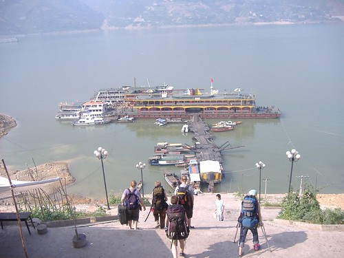
Since the river hasn't reached the permanent dock, temporary docks were built and the current level. Generally there is no way to get from the dock to the city other than climbing a buttload of stairs.
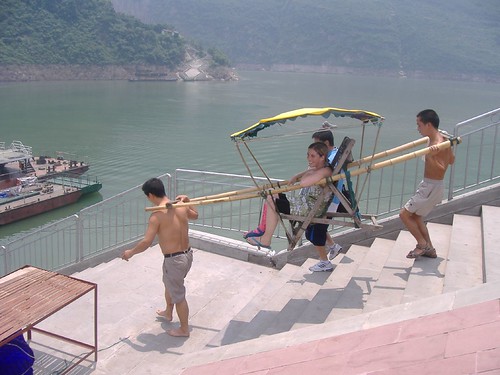
Out student Kate was traveling with a broken leg, which made the steps loathsome. Fortunately for Kate the oversupply of labor in China sometimes meant that she had alternative ways to travel.
 As much as I love travelling through China and find it a mesmerizing place, there is one thing that I find really troubling. It is impossible (ok, very difficult) to find any place that has not been disturbed by humans in some manner. Rob and I first talked about this in terms of soil disturbance, and I thought it would be nearly impossible to find a truly well-developed natural soil profile, except in really remote areas. This doesn't apply to all parts of China, but there is a stunning lack of natural landscape. Even places set aside as parks or preserves tend to be groomed or landscaped, as Kate pointed out about the Stone Forest.


 It's really hard to get accurate information about these dam plans. We heard several different versions from people we met, ranging from a huge single dam to a series of 8 smaller dams through the 25 km long gorge. Note that the


